City Council to Meet Oct. 27, 2020
Included in each City Council information packet is a memo from the City Administrator offering a summary and context of items appearing on the agenda. We will begin publishing these memos here in our news feed to make them more accessible. You can sign up to be notified of news items, agendas and more by email.
Due to the COVID-19 pandemic, public health and safety concerns require City of North Liberty public meetings to be held electronically, so as to limit the spread of the virus. The public is invited to submit questions and comments in advance of the meeting for consideration submitting them to the City Clerk Tracey Mulcahey via email at [email protected].
This meeting may be accessed live by the public on the internet at northlibertyiowa.org/live.
Meeting Note
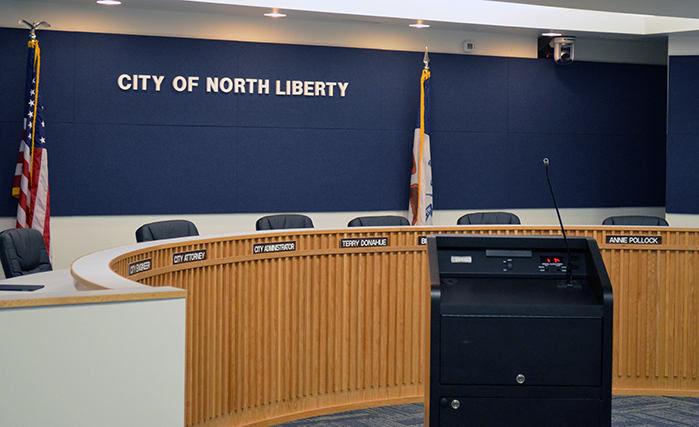
Tuesday’s meeting will be held virtually via Zoom and live streamed at Watch Meetings Live as well as available on the website. Participants will log into the meeting in order to conduct business while the public will be able to watch the debate and decisions being made.
Consent Agenda
The following items are on the consent agenda and included in the packet:
- City Council Minutes (10/13/20)
- Claims
- September Revenues
- September Treasure’s Report
- Liquor Licenses Renewals
- The Depot Express
- The Leaderboard
Mayor’s Report
Included in the packet is the Power Point presentation recently presented to the MPOJC Board regarding the light rail study. A video of the MPOJC Board meeting can be found here: https://citychannel4.com/cgi-bin/vdb/yt2.2.pl?id=F21162 The Mayor will ask for feedback from the Council during his report.
Ranshaw Way, Phase 5 Presentation
City Engineer, Kevin Trom, and his Shive Hattery team will provide a high level design overview of the upcoming Ranshaw Way project. In addition to functional improvements between Zeller Street and Hawkeye Drive, the project will include a pedestrian tunnel as well as incorporating ideas generated through the visioning project. Included in the packet are a handful of sketches showing the landscape theme. Additional presentation materials will be available at Tuesday’s meeting.
GIS Agreement
The FY21 budget includes funding in the water ($45,000) and wastewater ($105,000) budgets for implementing GIS technology. This has been a project that staff has been eager to accomplish for the last few years but put on the back burner for budgetary reasons. With funding now in the budget, staff is excited to move forward. Mapping is a critical tool that is used daily in the public works departments. GIS mapping has many benefits and will provide numerous efficiencies for City staff, including:
- Improving speed of locating utilities, which are often times buried by dirt or snow (or both), damaged, or not accurately identified on a PDF
- Allowing for more frequent updates to the mapping
- The cloud based system will be easily accessible on tablets or phones in the field. Currently print maps are utilized because complete map pdf files are too big to download on a phone or tablet. Print maps present their own challenges when used in the
- The system will have the ability to create work orders instantly as situations
arise. All repairs, alterations and investigations can be tracked within this program, as well as who performed the work, and the current condition, size and material of infrastructure. This information builds institutional knowledge into the software and will help staff schedule routine maintenance and monitor troubled areas.
Staff has researched multiple vendors and is recommending Council approve an agreement with Midland GIS in the amount of $175,518. On a related note, once storm water rates are restructured, staff will present another agreement with Midland GIS for mapping the storm water infrastructure.
South Slope Lease Agreement
The City has acquired a parcel of land west of I-380 as part of the Southwest Growth Area Utility project, for the purpose of housing a sanitary sewer lift station. South Slope Co-op has asked to lease from the City, a 36’ by 48’ plot of ground within that parcel for the purpose of building a structure, at South Slope’s expense, to house telecommunications equipment. The City has negotiated a 25 year lease at $1,000/year with a 10% rate increase every five years. This collaboration is a great example of a public/private partnership that will save money for both tax payers and South Slope members. Staff recommends approval of the agreement.
Traffic Stop Data Analysis Agreement
Chief Venenga has been working with Dr. Chris Barnum on an agreement to analyze annual traffic stop data regarding racial disparities in policing. This agreement is for calendar years 2021 and 2022 and the presentation of the analytics will coincide with the other policing data and statistics that Chief Venenga will present annually. The intent of analyzing the data is to determine if racial disparities exist, identify where within the department they exist and start developing a plan to eliminate the disparities. Staff recommends approval of the agreement. .
Street Name Amendment
This is a staff initiated street name change. An internal group of City staff members met and agreed that the street name change mid-block from Ogden Drive to Ogden Court could be confusing. Unfortunately, this was discovered late in the subdivision final plat process. Staff is recommending the entire street be named Ogden Lane, which would meet City street naming standards. Staff has spoken with the developer who expressed no objection to the request. Staff recommends City Council approve the change.
Purchasing Policy Amendment
Shortly after the City Council approved the recent revisions to the City’s Purchasing Policy, FEMA, as they prepared to issue the City funds to reimburse for COVID and Derecho events, asked staff to make a modification to the purchasing policy. The policy incudes a new section entitled “Contracts” and starts on page 23 of the policy document, which is included in the packet and recommended for approval.
Stoakes Settlement Agreement
The owner of the building just east of the new police station has expressed concerned over the landscaping buffer between the side yards. In an effort to alleviate some of the concerns and to be a good neighbor, staff has negotiated an agreement with Mr. Stoakes. Staff recommends approval of the agreement, paying Mr. Stoakes $1,000 that can be used to enhance landscaping on his side of the property.
Parking Resolution
The Watts Development Group, Inc. is requesting that the no parking regulation be changed from the west and south side to the east and north side of Oak Terrace Lane. The request is in part due to the type of development proposed for Lot 29, which would only have a single driveway access to Oak Terrace Lane. Additionally, on-street parking on the east side of Oak Terrace Lane would be limited due to driveways of the duplex units. Staff recommends City Council approve the change.
Forevergreen Road & Kansas Avenue Speed Limit Revisions
Staff is requesting that the speed limit be increased for portions of S. Kansas Ave. and W. Forevergreen Rd based on traffic speed studies (included in the packet) performed by the MPO. The traffic speed studies analyzed traffic counts, traffic speeds and crash data. The studies recommend that the speed limit be increased to 45 mph for S. Kansas Ave. (from south of Denison Ave. to W. Forevergreen Rd.) and W. Forevergreen Rd. (from western City Limits to Covered Bridge Rd.). These roadway sections will be further analyzed when future development occurs. Staff recommends City Council approve the change.
City Clean Up Day
In April, the City postponed the annual spring cleanup day due to COVID-19, with intensions to reschedule later in the year. With unrelenting COVID concerns and then Derecho impacting workloads, there will not be an opportunity to reschedule the cleanup day. In an effort to try and provide a hybrid service, staff is recommending Council allocate up to $10,000 for a landfill voucher and garbage sticker program. There are still some logistical issues to be resolved, but the idea is that residents would be offered an option to register for a landfill voucher or two garbage stickers that can be used for curbside pickup. The program would start November 9 and end on November 30. The FY21 budget includes $7,500 for cleanup day. The remaining $2,500, if needed, would be funded with general fund dollars, specifically those recently received from the CARE act revenues.
The Preserve Rezoning Request
Watts Development Group, Inc. is requesting a zoning map amendment to allow 7.87 acres – south of Denison Avenue and west of Oak Terrace Lane – to be developed with 26 single-family dwellings and related infrastructure. The development is proposed to be condominium owned. The PAD is being requested to allow the flexibility of having multiple single-family residences on one lot, which is not permitted in the RS and RM Districts alone. Although the Planning Commission unanimously recommended approval of the request at its October 2, 2020 meeting, one expressed concern was the lack of visitor parking within the development. Notably, the proposed development meets minimum parking requirements and allows for two additional parking spaces in the driveway. Additionally, the aforementioned parking change on Oak Terrace Lane will accommodate approximately 20 parked vehicles. Staff recommends approval of the zoning change request.
Zoning Ordinance Revisions, Third and Final Reading
This is a staff initiated amendment to the Zoning Ordinance. Changes include amending definitions, which in part include diagrams, amending the regulations for accessory buildings, reorganizing yard and height regulations into table format, and updating certain design standards. One of the proposed changes, increasing the maximum garage size for larger lots, was a suggestion from a citizen who was recently denied a variance by the Board of Adjustment. Staff agrees that larger lots should have the option for a bigger garage.
Staff is taking a phased approach to modernizing and making the Zoning Ordinance more user friendly. Another amendment is anticipated in the near future.